Marrakech to Merzouga Distance: Complete Km, Miles & Route Breakdown
Exact Marrakech to Merzouga distance: 560 km / 348 miles. Multiple route options with detailed km breakdowns, driving times, and practical road information.
Marrakech to Merzouga Distance: Complete Breakdown in Km & Miles
Quick Reference
| Metric | Value | |--------|-------| | Shortest Route | 560 km (348 miles) | | Longest Scenic Route | 620 km (385 miles) | | Driving Time | 9-10 hours | | With stops | 11-14 hours |
Distance by Route Option
Route 1: Scenic Mountain Pass Route
Distance: 560 km (348 miles)
Time: 9-10 hours driving
Segment-by-segment breakdown:
-
Marrakech → Tizi n'Tichka Pass
- Distance: 60 km
- Time: 1 hour
- Elevation: 2,260m
- Highlights: Mountain pass, panoramic views
-
Tizi n'Tichka → Ait Ben Haddou
- Distance: 35 km
- Time: 45 minutes
- Highlights: UNESCO World Heritage kasbah
-
Ait Ben Haddou → Ouarzazate
- Distance: 35 km
- Time: 1 hour
- Highlights: City center, shops, restaurants
-
Ouarzazate → Dades Valley
- Distance: 100 km
- Time: 1.5-2 hours
- Highlights: Valley views, Berber villages
-
Dades Valley → Todgha Gorge
- Distance: 100 km
- Time: 1.5-2 hours
- Highlights: Dramatic canyons, scenic gorge
-
Todgha Gorge → Erfoud
- Distance: 120 km
- Time: 2-2.5 hours
- Highlights: Desert transition zone
-
Erfoud → Rissani
- Distance: 50 km
- Time: 1 hour
- Highlights: Traditional trading town
-
Rissani → Merzouga
- Distance: 35 km
- Time: 45 mins - 1 hour
- Highlights: Sand dunes approaching
Total: 560 km, 9-10 hours
Route 2: Direct Highway Route
Distance: 550 km (341 miles)
Time: 8.5-9.5 hours driving
Segment breakdown:
- Marrakech → Ouarzazate: 130 km (2.5 hours)
- Via Tizi n'Tichka Pass
- Ouarzazate → Errachidia: 200 km (3-3.5 hours)
- Via N10 highway
- Errachidia → Erfoud: 110 km (2 hours)
- Straight N13 route
- Erfoud → Merzouga: 85 km (1.5-2 hours)
Total: 550 km, 8.5-9.5 hours
Route 3: Scenic Northern Loop
Distance: 620 km (385 miles)
Time: 11-12 hours driving
Segment breakdown:
- Marrakech → Fes: 460 km (7-8 hours)
- Fes → Merzouga: 160 km (3-4 hours)
Total: 620 km, 10-12 hours
Distance Conversions
Meters & Kilometers
- 560 km = 560,000 meters
- 550 km = 550,000 meters
- Average road: 1.4-1.6 meters wide
Miles & Yards
- 560 km = 348 miles
- 550 km = 341 miles
- 1 mile = 1.609 km
Practical Comparisons
- Marrakech-Merzouga distance =
- ~Same as London to Rome
- ~Same as New York to Chicago
- ~Same as Sydney to Melbourne
Distance by Landmarks
From Marrakech to Major Stops
| City/Landmark | Distance | % of journey | |---------------|----------|--------------| | Tizi n'Tichka Pass | 60 km | 11% | | Ait Ben Haddou | 95 km | 17% | | Ouarzazate | 130 km | 23% | | Dades Valley | 230 km | 41% | | Todgha Gorge | 330 km | 59% | | Erfoud | 450 km | 80% | | Rissani | 500 km | 89% | | Merzouga | 560 km | 100% |
Merzouga to Other Cities
From Merzouga to: | Destination | Distance | Time | |--------------|----------|------| | Rissani | 35 km | 45 mins | | Erfoud | 50 km | 1 hour | | Errachidia | 150 km | 2.5 hours | | Ouarzazate | 360 km | 5.5-6 hours | | Fes | 470 km | 7-8 hours | | Marrakech | 560 km | 9-10 hours | | Casablanca | 700 km | 10-11 hours | | Tanger | 800 km | 12-13 hours |
Elevation Profile
Altitude Changes
- Marrakech: 450m
- Tizi n'Tichka Pass: 2,260m (↑1,810m)
- Ouarzazate: 1,160m (↓1,100m)
- Dades Valley: 1,320m (↑160m)
- Todgha Gorge: 1,400m (↑80m)
- Erfoud: 700m (↓700m)
- Merzouga: 600m (↓100m)
Total elevation gain: ~3,240m
Total elevation loss: ~2,940m
Most challenging section: Marrakech → Tizi n'Tichka Pass (steep, winding mountain road)
Road Quality by Segment
Excellent Roads (Highway Standard)
- Marrakech → Ouarzazate (N9): Well-paved, modern
- Ouarzazate → Errachidia (N10): Good quality, minor bumps
- Errachidia → Erfoud: Decent, some rough patches
- Erfoud → Merzouga: Basic but passable
Challenging Sections
- Tizi n'Tichka Pass: Winding mountain road, no guard rails, requires focus
- Desert tracks near Merzouga: Possible sand drifts, 4x4 helpful but not required in vehicle lane
Surface Types
- Asphalt: 85% of route
- Paved but worn: 10% of route
- Rough/sandy: 5% of route (near Merzouga)
Fuel Consumption & Tank Range
Car Types & MPG/Liters
Economy Car (Fiat Punto, Renault Clio)
- Consumption: 8-10 L/100km
- For 560 km: 45-56 liters needed
- Tank size: 45-55 liters
- Range: 400-550 km on full tank
- Requires 1-2 fill-ups
SUV/4x4 (Toyota Fortuner, Dacia Duster)
- Consumption: 10-12 L/100km
- For 560 km: 56-67 liters needed
- Tank size: 60-70 liters
- Range: 450-600 km on full tank
- Requires 1 fill-up
Fuel Stations Along Route:
- Marrakech (start with full tank)
- Ouarzazate (200 km mark - refuel)
- Errachidia (optional backup)
- Rissani (last chance before Merzouga)
- Merzouga (emergency backup, higher prices)
Fuel Cost Calculation
- Current price: ~€0.90/liter (varies)
- Economy car: ~€40-€50 for journey
- SUV: ~€50-€60 for journey
Cost-Saving Tips
- Fill up in larger cities (cheaper than rural areas)
- 2-3 liters cheaper in Ouarzazate vs. Merzouga
- Avoid Merzouga fill-ups (can be 20% more expensive)
Speed Analysis
Average Speeds by Section
| Section | Speed | Reason | |---------|-------|--------| | Marrakech-Ouarzazate | 50 km/h | Mountain pass winding | | Ouarzazate-Errachidia | 70 km/h | Highway, straighter | | Errachidia-Erfoud | 55 km/h | Varies, some winding | | Erfoud-Merzouga | 50 km/h | Desert approach, sandy | | Average for trip | 56 km/h | Mix of terrain |
Time Breakdowns
- Optimal drive (no stops): 9 hours 55 minutes
- Add fuel stops (+1 hour): 10 hours 55 minutes
- Add rest breaks (+1 hour): 11 hours 55 minutes
- Add photo ops (+1-2 hours): 11-13 hours
- Realistic with stops (1-2 hrs): 11-14 hours
Distance Landmarks & Photo Opportunities
km 0-60: Mountain Ascent
- Tizi n'Tichka Pass (km 60)
- Elevation: 2,260m
- Photo: 360-degree mountain views
- Stop time: 20-30 mins
km 60-130: Kasbah Region
- Ait Ben Haddou (km 95)
- UNESCO World Heritage Site
- Photo: Dramatic mud-brick fortress
- Stop time: 45-60 mins
km 130-230: Valley & Plateau
- Ouarzazate (km 130)
- City center, souks
- Photo: Valley overview
km 230-330: Gorges & Valleys
-
Dades Valley (km 230)
- Photo: Scenic valley
- Stop: 30-45 mins
-
Todgha Gorge (km 330)
- Photo: Dramatic canyon
- Photo: Best for sunrise/sunset light
- Stop: 45-60 mins
km 330-450: Desert Transition
- Erfoud (km 450)
- Fossil shops
- Photo: Gateway to desert
km 450-560: Final Desert Push
-
Rissani (km 500)
- Traditional market town
- Photo: Berber architecture
-
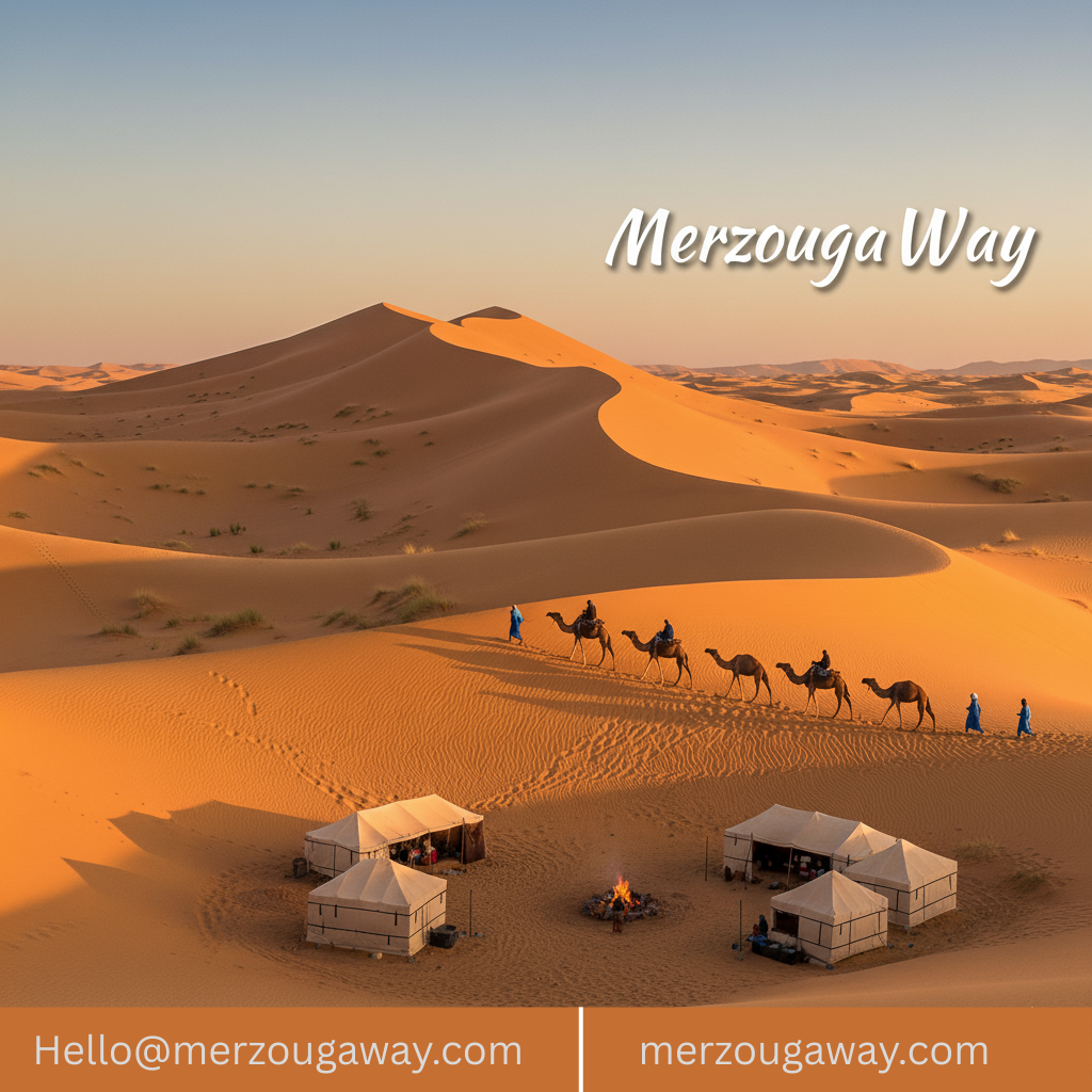
Merzouga (km 560)
- Erg Chebbi dunes
- Photo: Golden hour over dunes (magical!)
Planning by Distance-Based Stops
Option 1: Single Day (560 km)
- Depart: 7-8 AM
- Fuel stops: 1-2 (30 mins each)
- Photo stops: 2-3 (20 mins each)
- Meal break: 1 (45-60 mins)
- Arrive: 5-7 PM
- Total time: 10-12 hours
Option 2: Two Days (280 km each day)
-
Day 1: Marrakech → Dades Valley (230 km, 3.5-4 hours driving)
- Explore Ait Ben Haddou, Ouarzazate
- Afternoon gorge hiking
- Overnight in Dades
-
Day 2: Dades Valley → Merzouga (330 km, 5.5-6 hours)
- Morning in Dades/Todgha
- Afternoon drive to Merzouga
- Sunset camel trek
RECOMMENDED for most travelers
Option 3: Three Days (200-280 km each day)
- Day 1: Marrakech → Dades Valley (230 km)
- Day 2: Dades Valley only (0 km) - explore gorges, hike, relax
- Day 3: Dades Valley → Merzouga (330 km)
Best for photographers, nature lovers
Hiking Distance from Merzouga
From Merzouga Camp to Attractions
| Attraction | Distance | Time | |------------|----------|------| | Erg Chebbi Dunes | 0-5 km | 20-45 mins | | Natural Spring | 2-3 km | 30-45 mins | | Berber camp | 5-10 km | 1-2 hours | | Hassi Labiad Spring | 10 km | 2-3 hours by camel/4x4 |
FAQs About Distance
Q: How many kilometers from Marrakech to Merzouga?
A: 560 km via main scenic route, 550 km via direct route.
Q: Is 560 km doable in one day?
A: Yes, but tiring. Most prefer spreading over 2-3 days.
Q: What's the shortest driving time?
A: 8.5 hours (direct route, minimal stops, experienced driver).
Q: What's realistic driving time with stops?
A: 11-14 hours (includes photo stops, meals).
Q: Where should I refuel?
A: Ouarzazate (200 km mark) and Rissani (emergency backup).
Q: Is the Tizi n'Tichka Pass driving difficult?
A: Moderately—winding road, but well-maintained. Not extreme.
Q: How many hours of driving per day is safe?
A: Generally 6-8 hours max before fatigue becomes issue.
Q: Can I cover this distance comfortably alone?
A: Yes, but take breaks every 2-3 hours, stop overnight if fatigued.
Summary
- Total Distance: 560 km (348 miles)
- Shortest Time: 8.5 hours (non-stop, direct route)
- Realistic Time: 11-14 hours (with reasonable stops)
- Recommended: 2-3 days via organized tour
- Fuel Cost: €40-€70 (depending on vehicle)
- Most Scenic: Route via Ait Ben Haddou, Dades Valley, Todgha Gorge
Ready to Plan Your Journey?
MerzougaWay offers:
- 3-Day Tours (perfect distance split): €300-€450
- Distance-optimized itineraries: Custom planning
- Transportation only: Private transfers €250-€350
Book Now: hello@merzougaway.com | +212 675 203 319